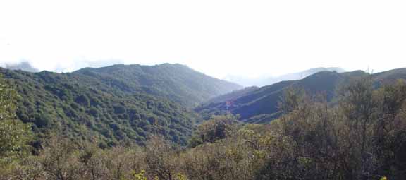
Garrapata Creek flows year-round. It
starts in the Los Padres National Forest in the Santa Lucia Mountains. It
flows across public and privately owned land as it joins with Wildcat Creek
and Joshua Creek before emptying into the Pacific Ocean at Garrapata Beach
State Park (9.7 miles south of the Rio Road and Highway One in
Carmel). Our watershed is approximately 10.6 square miles in size.
A group of concerned residents, owners and land managers in the our watershed
have gathered together to help support the environment surrounding the stream. We value
the sparkling, cool, clear water in our creek and the spectacular natural setting that make this a unique spot. We
are learning ways in which all of us together can improve the water quality now and for
the future. We organized ourselves into a community-based group called the
Garrapata Creek Watershed Council. This group is made up of all owners,
residents, property managers and others interested in the health of the creek and its
tributaries. Our first general meeting was held June 3rd 2000. We
usually have one General Meeting a year. Next meeting is planned for summer
2010; more details later.
We continue to learn more about the condition of our creek through creek walks and
inviting educational institutions like C.S.U.M.B. to conduct student projects that
help us and the students. We have installed stream gauges to measure the flows of the
creek.
In our watershed plan we learned that roads in the watershed can be improved in
order to reduce impacts on our steelhead and also reduce road repair costs. We are
in the final stages of finishing an upslope erosion reduction project that
upgraded almost 14 miles of private and public roads. We are just about done
working on
the county section of Garrapatos Road (located off Palo Colorado
Road). We had to wait until the end of the rains before we could reschedule the work.
The only job left is to install a few flex pipes from the new dips; that
work should be completed by 2nd week of August 2010.
l